


Met Eireann has issued a Status Yellow wind and rain warning for Donegal ahead of Storm Brian’s arrival tonight, just days after a Status Red warning due to ex-Hurricane Ophelia.
“Storm Brian, a rapidly deepening depression in the mid-Atlantic, is expected to fill as it tracks over parts of Ireland late Friday night and early on Saturday,” Met Eireann says.
“Some flooding expected, most especially in coastal regions, where very high seas will also pound the coasts.
“Take extra care, as some structures may have been weakened from the effects of the recent storm Ophelia.
“It should be noted that various parts of the country will experience the very strong winds at different times during this period and northern counties are not expected to encounter the peak winds until Saturday afternoon.”
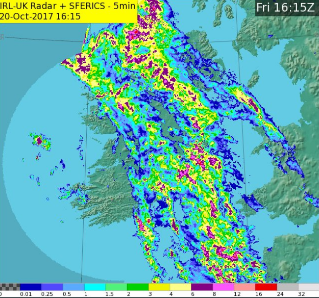
A rainband ahead of #StormBrian continues to move NEwards across the country. 5 to 15mm generally.
Becoming very windy tonight with showers. pic.twitter.com/udGuKb0yJ4— Met Éireann (@MetEireann) October 20, 2017
South or southeast winds, later becoming northwest will reach mean speeds of 55 to 65 km/h with gusts up to 110 km/h throughout Saturday.
They expect the strong winds to pick up at 10pm tonight, with the warning being valid until 10pm tomorrow night.
The strong winds will occur in various parts of the country during different time periods, with winds in northern areas probably not peaking until Saturday afternoon.
Heavy rain with accumulations of 30 to 50mm is also expected tomorrow.
Donegal is not expected to be badly struck, with Status Orange warnings only being issued for Mayo, Galway, Clare, Kerry, Cork, Waterford and Wexford.
Tags: