


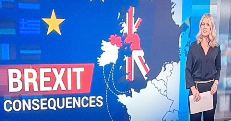
TV viewers had to do a double take last night when an RTE image erroneously placed Donegal in the UK.
The map, which seemed to locate Donegal within Northern Ireland, featured on a segment on the consequences of Brexit on the Nine O’Clock News.
The image set social media alight with comments from people who were left scratching their heads.
The county mapping office wanted to set things right and offered some guidance to the broadcaster:
@rte check out our #Donegal map portal to see where the border is! https://t.co/IKPxecRrv8 Geography matters! Let’s get it right. pic.twitter.com/SFxIJPvteg
— DonegalMaps (@DonegalMaps) January 7, 2021
We lost Donegal in the Brexit deal! pic.twitter.com/W3ZUKUDsxL
— Shane Hegarty (@shanehegarty) January 7, 2021
Sinn Féin Councillor Jack Murray was one of the many who were stunned by the image.
Cllr Murray wrote on social media: “Hang on, what? Donegal is most definitely the forgotten county as far as RTE is concerned. The partitionist ethos of our ‘national’ station is bad enough but look at the shape of this map! They’ve literally forgotten where Donegal even is.”
Independent Councillor Michael Cholm Mac Giolla Easbuig was also bemused by the error, writing: “This is why RTE and the Dublin government keep ignoring and neglecting us….. ![]() “
“
Ummm rte everything okay with Donegal there pic.twitter.com/yZ1HBPYBBv
— róisín (@rosenrosey) January 7, 2021