Donegal Daily
  • News
  • Sport
  • Courts
  • Jobs
  • Business
  • Lifestyle
  • Travel
  • Politics
  • Features
  • Donegal County Council News
Wednesday 19°CThursday 18°C

Donegal Daily Donegal Daily

sponsor banner
sponsor banner
  • News
  • Sport
  • Courts
  • Jobs
  • Business
  • Lifestyle
  • Travel
  • Politics
  • Features
  • Donegal County Council News
News

SNOW WARNING UPDATE: RAIN TURNING TO SNOW THROUGHOUT DAY, SAYS FORECASTER

written by admin January 18, 2013
FacebookTweetLinkedInPrint

Burt-in-the-snow-by-Caroline-Kuyper3 last JanuaryTHE Meteo Times weather channel has issued a latest update on snow across the North West.

After a stormy night, rain is slowly turned to sleet and snow, says forecaster Peter O’Donnell.

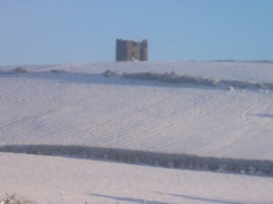
Snow has already fallen on the mountains and many hills.

Here’s the latest update from Peter:

The front that swept through Ireland overnight has stalled and colder air is mixing into the moisture, changing rain to sleet. Some accumulating snow will begin later this morning over higher parts of Ulster. Gradually, from this afternoon to mid-day Saturday, low pressure will develop over Ireland organizing this mixed bag of precipitation while temperatures continue to fall slowly everywhere, and this will continue to shift the balance between rain and snow both in terms of elevation and from north to south.


By Saturday night it will probably become cold enough to snow just about anywhere but moisture may then begin to break into less organized patterns, so snowfall later in the weekend will be hit or miss. The east coast will be favoured because of sea effect but as the Irish Sea is quite warm compared to the air mass, sea level areas in Dublin and Wicklow could see sleety or mixed showers. The potential for heavy snow in all of this remains highest, I believe, in two places, hills of Donegal and Derry and some other parts of the north, and from about 150m to near summit levels on the east side of the Dublin and Wicklow Mountains. Eventually about half to two-thirds of Ireland’s land mass should be covered in at least 2-4 cm of snow and a few places will see more, perhaps 15-25 cm on higher ground in some isolated instances. This period will bring widespread mixed sleety precipitation before snow and coatings of ice or half-frozen slush will make walking and driving difficult at best. Plan for delays and perhaps one or two closed roads in hilly areas.


SNOW WARNING UPDATE: RAIN TURNING TO SNOW THROUGHOUT DAY, SAYS FORECASTER was last modified: January 18th, 2013 by admin
FacebookTweetLinkedInPrint

Tags:
donegal daily weather forecastSNOW WARNING UPDATE: RAIN TURNING TO SNOW THROUGHOUT DAY
admin

LEAVE A COMMENT

You may also like

Celtic fan Mark to walk from Donegal...

1 hour ago

Notice: Ballybofey, Stranorlar & District Historical Society...

2 hours ago

Permission sought for new creche and playground...

3 hours ago

Median house price in Donegal rises to...

4 hours ago

Bluestack Challenge supports Donegal players on Ireland...

5 hours ago

Donegal to receive almost €500,000 for five...

8 hours ago

Donegal Monsignor to host delegation of Irish...

8 hours ago

National: Boy seriously injured in e-scooter incident...

8 hours ago

Sad passing of Carrigans community hero, Jim...

9 hours ago

Thunderstorms caused major outages in south Donegal...

10 hours ago
Advertisement
Advertisement

Donegal County Council

Facebook
Donegal County Council
Advertisement
Advertisement
Donegal Daily Jobs

Read More

  • News
  • Sport
  • Courts
  • Jobs
  • Sales & Services
  • Obituaries
  • Features
  • Business
  • Politics
  • Council News

Information

  • Contact Us
  • About
  • Advertise WIth Us
  • Privacy Policy
  • Disclaimer
  • Terms & Conditions

Our Sites

Donegal Woman
Donegal Woman
Donegal Daily

© 2025 Donegal Daily. All rights reserved.
Website by owenod


Back To Top.

We use cookies to ensure that we give you the best experience on our website. If you continue to use this site we will assume that you are happy with it.OkPrivacy policy